When picturing the history behind a river you might imagine that would include incidents such as floods were it may have broken its banks or when there were droughts and the river reduces to a stream, and you’d be right, but the true history of a river is infinitely more complex as it gradually shifts its shape over thousands and sometimes millions of years.
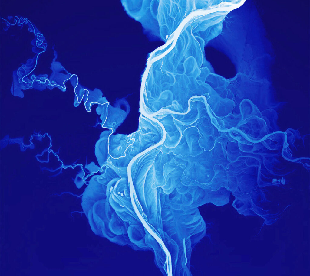
Cartographers and geologists have long tried to come up with ways to visualise this change in flow over a period of time however this amazing map created by Oregon cartographer Dan Coe is a little different. The map shows the Willamette River Historical Stream Channels of Oregon, created using data from more recent aerial radar technology called lidar which works by illuminating the ground with lasers and measuring the distance of the light reflected back.
Using this technology it is possible to strip away the vegetation and buildings so that only the ground is show. In the photo you see below the shades of white and blue represent the changes in elevation ranging from 0 to 50 feet over the last 12,000 to 15,000 years. For more information you can head here.

Thousands of people are receiving exclusive BlazePress-related content from our monthly newsletter. Don’t miss out, subscribe here.