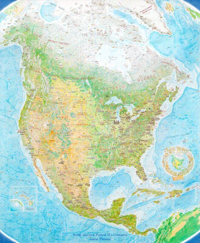
It’s one thing to design and print a large-scale detailed map of a continent, but it’s another feat entirely to create a hand drawn US map from scratch. Each detail created by hand to create something no less than a masterpiece.
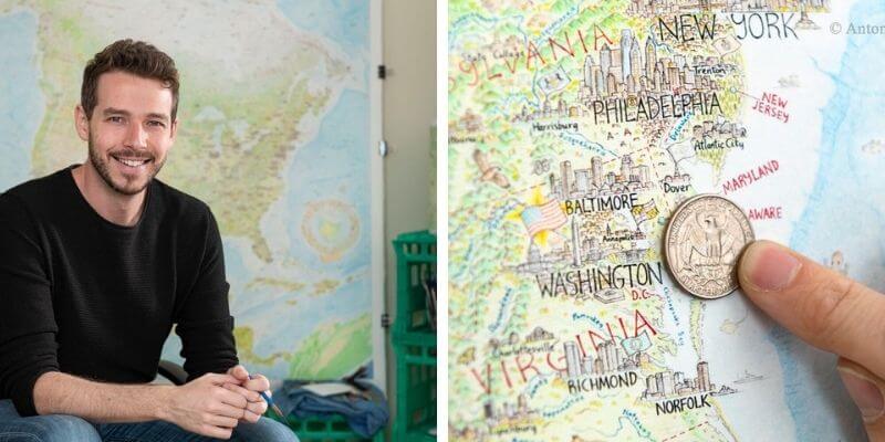
This is exactly what artist and cartographer Anton Thomas accomplished over the course of 5 painstaking years. Thousands of hours were spent planning, drawing, and coloring a uniquely detailed map of North America, and his creation is impossible to ignore.
 Source: My Modern Met
Some people might wonder what compelled Thomas to spend hours and hours’ worth of time to draw this map. His passion and the journey he took to finish this map might just inspire you!
Who is Anton Thomas and why did he create the hand drawn US map?
To understand the motivation behind this hand-drawn map, we must first get to know the artist behind it.
Anton Thomas is a New Zealander who was obsessed with maps as a little boy. The landscapes of his place of birth were never short of geographic inspiration, with breathtaking views and various topographical features enough to entice anybody’s eye.
This encouraged him to start drawing maps at a young age. From coastlines to pictorial maps, Thomas continued to draw maps as a hobby until he left New Zealand at 21, where he started to pursue this passion as something beyond a simple hobby.
One Way Ticket to America
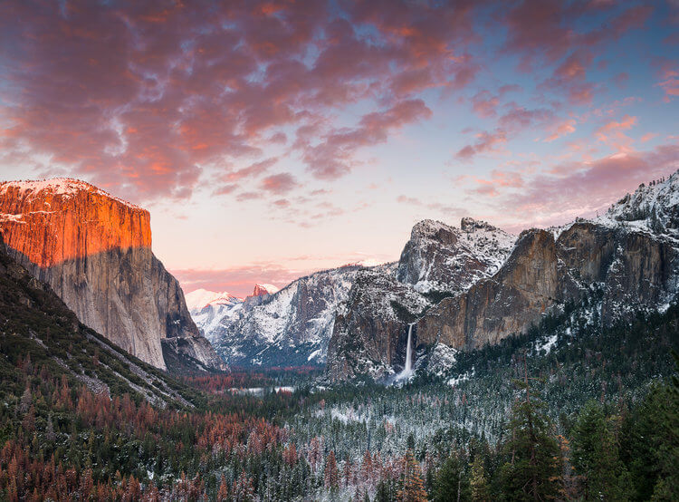
Thomas wanted to see what the rest of the world had to offer, so he booked a one-way ticket to California, where he was fascinated by the scale and variety of the landscape.
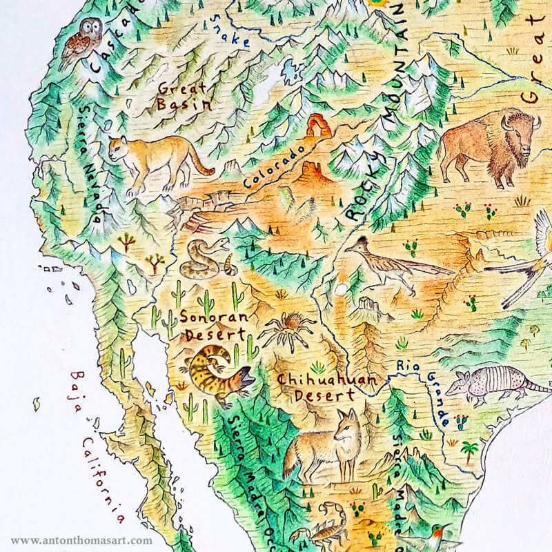
In just that state, he could see redwoods, mountains, and deserts, prompting a wonder about what the rest of the country had to offer.
 Source: Nigel Danson
After California was Canada, and these travels resulted in a resurgence of his imagination of what a cross country map would look like.
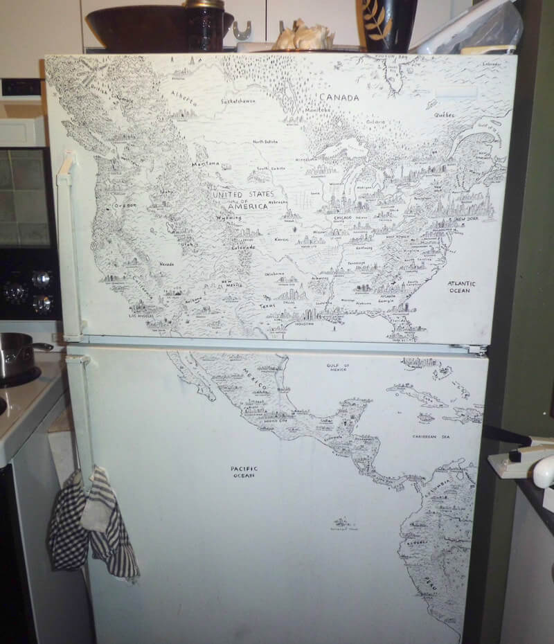
It was almost as if he could envision his travels on a large map, and sure enough, Thomas started to sketch again—on a fridge of all places! Thus the idea for a large-scale, hand-drawn map of North America came to be for this traveler and artist.
 Source: Anton Thomas
The Famous US Map
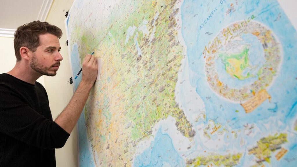
After moving to Melbourne, Thomas began taking the North America map project seriously. Armed with colored pencils and a projector, he traced out the borders of a 1.5 x 1.2 meter map and began to sketch in his spare time while working at a school.
In an interview, later on, Thomas stated that this was the reason the map took so long; he could only really work on it when he had free time.
 Source: Anton Thomas
The map started coming together slowly as Thomas improved his drawing skills and perception of geography.
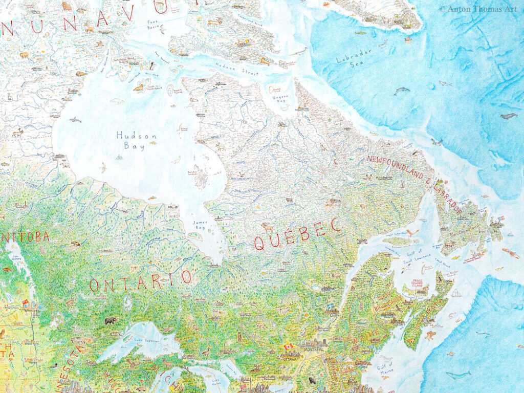
Every detail was completed with patience as the artist learned that no place could be rushed. With the firm belief that places are integral parts of who we are, he continued to draw detailed miniature versions of cities, forests, suburbs, and towns with the utmost care to preserve the integrity of the geography.
 Source: Anton Thomas
Challenges
Any project of this scale and proportion is bound to encounter challenges, whether major or minor. For Thomas, an improvement in his drawing led to redoing a huge portion of the map.
To redo the western half of North America and western Canada, Thomas even went as far as scratching off the pen using an Exacto knife.
“It was the most grueling stage, and it went on for a year,” he said during the interview. Fortunately, the technique paid off, and the map came out better than before.
 Source: Anton Thomas
What’s Next for Anton Thomas?
 Source: Anton Thomas
Drawing the massive map was not just for nothing, and life has changed for Thomas since finishing the gargantuan project.
He had stayed so focused on the map for five years until its completion in February 2019 that the weeks post-completion felt strange to him.
It was an emotional time, and he almost couldn’t believe he finished it. Since then, he has spent more time on his business and taken a much-needed break from drawing the map.
However, this doesn’t mean that Thomas’ map-drawing career is completely over. He still completed several projects here and there, one of the most notable being a series of maps and illustrations completed for The Washington Post in mid-2019.
 Source: Anton Thomas
In July 2020, Thomas announced the beginning of a new project, which is a map called Wild World.
Finding his way back to drawing maps with a new set of eyes is an exciting endeavor, and the world can’t wait to see the magic he comes up with next!